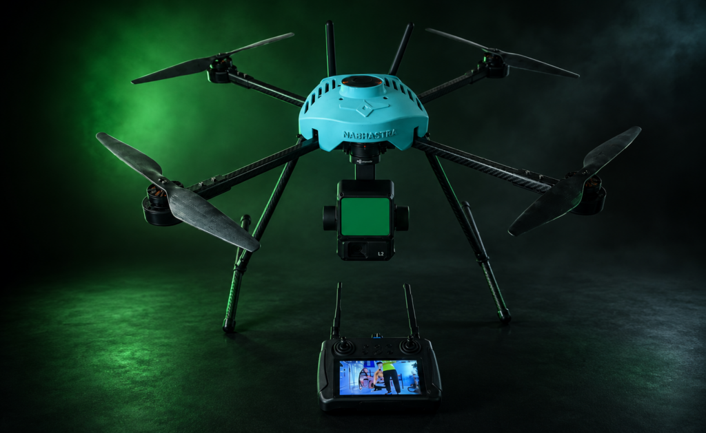
Nabhastra

Surveillance Drone

DRISHTI MK I SURVEILLANCE DRONE

Size

650 mm

Motor

4010 380KV

Battery

6S 15000mAh

Flight Time

Up to 45 Min

DRISHTI is an advanced AI-powered surveillance drone built for real-time intelligence, autonomous missions and precise target identification. Engineered for superior situational awareness, it combines intelligent autonomy, extended endurance and rugged reliability for mission-critical operations.

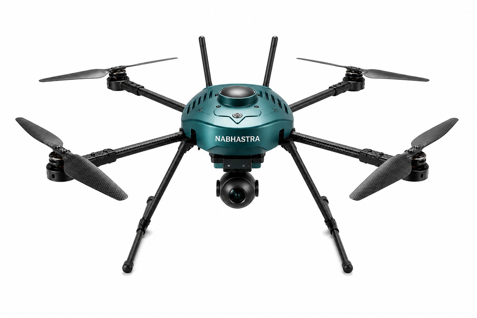
AUTONOMOUS FLIGHT

  • Waypoint-based autonomous navigation
  • Auto take-off, mission execution & landing
  • Obstacle detection & intelligent rerouting
  • Return-to-Home & failsafe protocols
  • Geofencing & no-fly zone awareness


SMART. PRECISE. RELIABLE.

ParameterSpecification
Max Payload1.5 KG
Max Speed60 KM/H
Max Altitude5000 M
Wind Resistance≤ 15 M/S
Max Range10 KM*
Weight≤ 4.5 KG
Battery6S Li-Po, 15000 mAh
Operating Temp.-10°C to +50°C

DRISHTI MK II SURVEILLANCE DRONE

AI POWERED SURVEILLANCE DRONE

SEE MORE. KNOW MORE. STAY AHEAD.

DRISHTI is an advanced AI-powered surveillance drone built for real-time intelligence, autonomous missions and precise target identification. Engineered for superior situational awareness, it combines intelligent autonomy, extended endurance and rugged reliability for mission-critical operations.
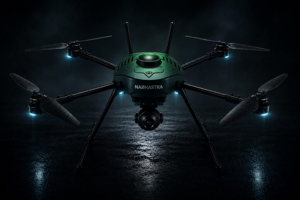
AI AUTONOMY

Intelligent Tracking & Target Identification


CORE CAPABILITIES

  • AI Powered Tracking
  • Target Identification
  • Autonomous Missions
  • Live ISR Feed

AI TRACKING & TARGET IDENTIFICATION

  • AI-enabled object detection and classification
  • Autonomous target tracking with adaptive learning
  • Human, vehicle & suspicious object recognition
  • Real-time alerts and intelligence feeds


SMART. PRECISE. RELIABLE.

ParameterSpecification
Max Payload1.5 KG
Max Speed60 KM/H
Max Altitude5000 M
Wind Resistance≤ 15 M/S
Max Range10 KM*
Weight≤ 4.5 KG
Battery6S Li-Po, 22000 mAh
Operating Temp.-10°C to +50°C

KEY TECHNICAL HIGHLIGHTS

AI Processor

  • Onboard AI for real-time analytics & detection

Brushless Motors

  • High efficiency & low noise

Carbon Fiber Frame

  • Lightweight, durable & foldable arms

Redundant Systems

  • GPS + GLONASS for precise navigation

Smart Battery

  • Intelligent BMS & power monitoring

Quick Deploy

  • Tool-less assembly & rapid deployment
Size

850 mm

Motor

 340 KV

Battery

12S 22000mAh Solid State

Flight Time

Up to 60 Min

LiDAR Survey Drone

General Platform Specifications

  • Drone Type: Multi-rotor LiDAR-based Survey UAV
  • Frame Size: 15-inch propeller class platform
  • Configuration: Electric propulsion, modular payload integration
  • Build: Compact, lightweight, ruggedised UAV platform
  • Deployment Modes: UAV-mounted, backpack portable, vehicle-mounted operations

Flight Performance Parameters

  • Endurance: 35–40 minutes
  • Operational Range: Up to 5 km
  • Maximum Flight Altitude: Up to 100 m AGL (Above Ground Level)
  • Flight Modes:
    • GPS-assisted flight
    • Manual FPV mode
    • Autonomous waypoint navigation

LiDAR Payload Specifications

  • Sensor Type: High-resolution LiDAR scanner
  • Channels: Up to 128 channels
  • Point Cloud Density: Up to 5.2 million points per second
  • Mapping Capability: High-accuracy 3D terrain and object mapping
  • Data Outputs:
    • Range data
    • Signal intensity
    • Reflectivity data
    • Near-Infrared (NIR) layer

Ground Control & Data Handling

  • GCS Type: Digital Full HD interface
  • Data Processing: Real-time acquisition with post-processing capability
  • Mapping Output: High-resolution 3D maps and terrain models
Size

750 mm

Payload

LiDAR Unit

Battery

6S 22000mAh

Flight Time

30–35 Min

Main Features

  • AI Powered Tracking
  • Target Identification
  • Autonomous Missions
  • Live ISR Feed

AI Tracking & Target Identfication

  • AI-enabled object detection and classification
  • Autonomous target tracking with adaptive lock
  • Human, vehicle & suspicious object recognition
  • Real-time alerts and intelligence feeds

Vehicle Detection Panel

  • VEHICLE IDENTIFIED
  • CONFIDENCE: 98%

Autonomous Flight

  • Waypoint-based autonomous navigation
  • Auto take-off, mission execution & landing
  • Obstacle detection & intelligent rerouting
  • Return-to-Home & failsafe protocols
  • Geofencing & no-fly zone awareness

Operational Capabilities

Intelligent Drone Solutions Powering the Future of Industries

LONG RANGE ISR

  • Real-time HD video transmission up to 10 km*
  • *Line of Sight

DAY & NIGHT ISR

  • 1080p Full HD Day Camera
  • & Low Light Night Vision

3-AXIS STABILIZED GIMBAL

  • Stable & precise imaging in all conditions

EXTENDED ENDURANCE

  • Up to 35 Min flight time for extended missions


RUGGED & RELIABLE

  • IP54 Protection
  • Operates in harsh environments (-10°C to +50°C)

SECURE CONNECTIVITY

  • Encrypted digital link with frequency hopping for secure communications

SMART. PRECISE. RELIABLE.

MAX PAYLOAD

1.5 KG

MAX SPEED

60 KM/H

MAX ALTITUDE

5000 M

WIND RESISTANCE

≤ 15 M/S

MAX RANGE

10 KM*

WEIGHT

≤ 4.5 KG

BATTERY

6S Li-Po, 6,000 mAh

OPERATING TEMP.

-10°C to +50°C

KEY TECHNICAL HIGHLIGHTS

AI Processor

Onboard AI for real-time analytics & detection

Brushless Motors

High efficiency & low noise

Carbon Fiber Frame

Lightweight, durable & foldable arms

Redundant Systems

GPS + GLONASS for precise navigation

Smart Battery

Intelligent BMS & power monitoring

Quick Deploy

Tool-less assembly & rapid deployment

get started

Still have questions?

Rooted in Tradition Driven by Innovation

faqs

Frequently Asked Questions

We provide aerial videography, photography, real estate shoots, events, mapping, and commercial projects.

Yes. All our pilots are fully certified and experienced in professional aerial operations.

We recommend booking at least 3–7 days before your project date.

Yes, but it depends on permit availability and local regulations. We handle the process when needed.

Usually 2–5 days depending on project complexity.

Absolutely. We tailor packages based on your project needs and budget.